


Fremont 21, Fremont County, Colorado
About
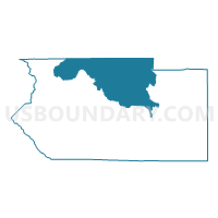
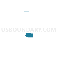
Outline

Summary
| Unique Area Identifier | 548205 |
| Name | Fremont 21 |
| County | Fremont County |
| State | Colorado |
| Area (square miles) | 270.19 |
| Land Area (square miles) | 270.18 |
| Water Area (square miles) | 0.01 |
| % of Land Area | 100.00 |
| % of Water Area | 0.00 |
| Latitude of the Internal Point | 38.63166980 |
| Longtitude of the Internal Point | -105.48523390 |
Maps

Graphs
Select a template below for downloading or customizing gragh for Fremont 21, Fremont County, Colorado


Neighbors
Neighoring Voting District (by Name) Neighboring Voting District on the Map
- Fremont 11, Fremont County, CO
- Fremont 12, Fremont County, CO
- Fremont 17, Fremont County, CO
- Fremont 18, Fremont County, CO
- Fremont 19, Fremont County, CO
- Fremont 22, Fremont County, CO
- Fremont 24, Fremont County, CO
- Fremont 25, Fremont County, CO
- Fremont 26, Fremont County, CO
- Park 6, Park County, CO
- Park 7, Park County, CO
- Teller 13, Teller County, CO
- Teller 5, Teller County, CO
Top 10 Neighboring County Subdivision (by Population) Neighboring County Subdivision on the Map
- Cañon City CCD, Fremont County, CO (29,226)
- Cotopaxi CCD, Fremont County, CO (3,462)
- Cripple Creek CCD, Teller County, CO (3,279)
- Lake George CCD, Park County, CO (2,179)
Top 10 Neighboring Place (by Population) Neighboring Place on the Map
Top 10 Neighboring Unified School District (by Population) Neighboring Unified School District on the Map
- Cañon City School District RE-1, CO (27,601)
- Park County School District RE-2, CO (6,962)
- Cripple Creek-Victor School District RE-1, CO (4,804)
- Cotopaxi School District RE-3, CO (2,735)
Top 10 Neighboring State Legislative District Lower Chamber (by Population) Neighboring State Legislative District Lower Chamber on the Map
- State House District 45, CO (110,234)
- State House District 60, CO (72,008)
- State House District 21, CO (66,065)
Top 10 Neighboring State Legislative District Upper Chamber (by Population) Neighboring State Legislative District Upper Chamber on the Map
Top 10 Neighboring 111th Congressional District (by Population) Neighboring 111th Congressional District on the Map
Top 10 Neighboring Census Tract (by Population) Neighboring Census Tract on the Map
- Census Tract 9785, Fremont County, CO (5,902)
- Census Tract 9783, Fremont County, CO (5,626)
- Census Tract 9790, Fremont County, CO (3,462)
- Census Tract 9786, Fremont County, CO (3,101)
- Census Tract 102.01, Teller County, CO (2,674)
- Census Tract 5, Park County, CO (2,179)
- Census Tract 9792, Fremont County, CO (1,754)
- Census Tract 9801, Fremont County, CO (945)
- Census Tract 102.02, Teller County, CO (605)
Top 10 Neighboring 5-Digit ZIP Code Tabulation Area (by Population) Neighboring 5-Digit ZIP Code Tabulation Area on the Map
- 81212, CO (29,742)
- 80816, CO (5,180)
- 80813, CO (2,055)
- 81223, CO (1,639)
- 80820, CO (806)
- 80860, CO (594)